IndexMapr
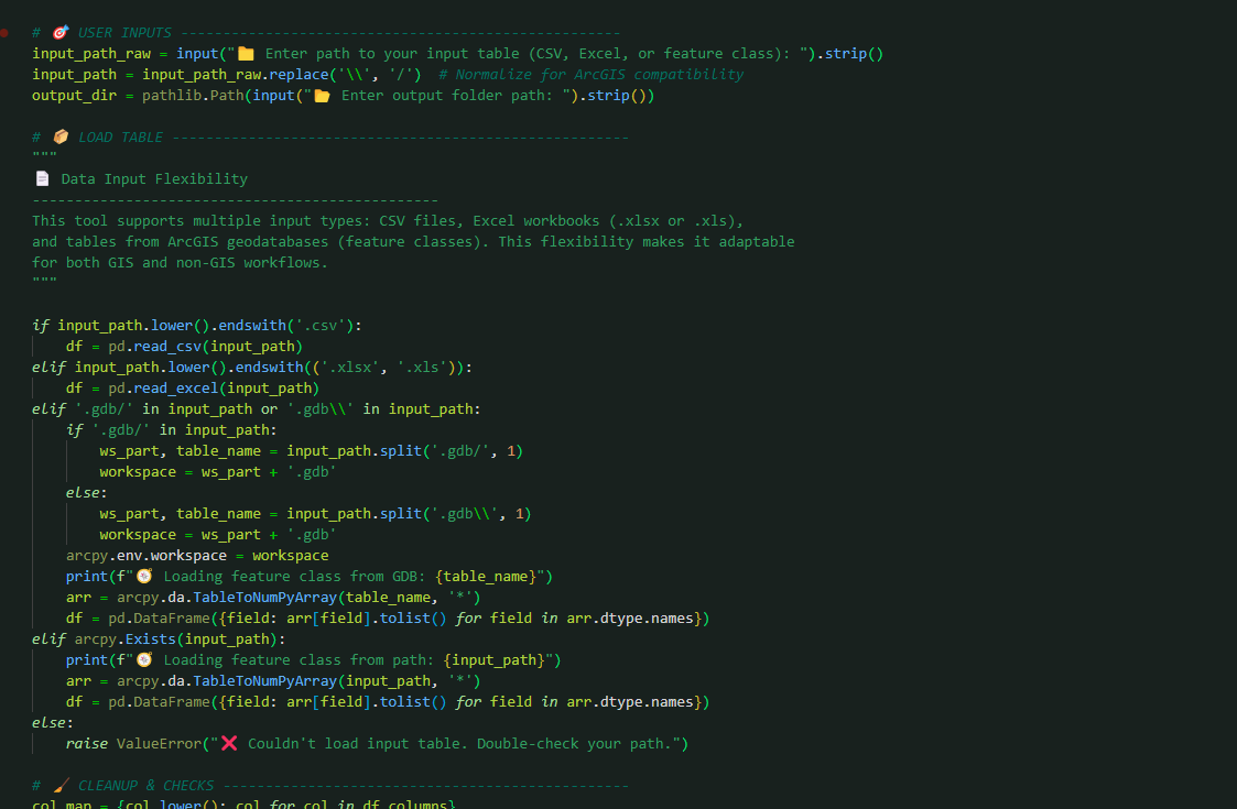
Field photo documentation is valuable, but manually organizing large volumes of photos can quickly become a bottleneck. In this project, I built a Python-based utility that automatically organizes field photos into structured folders based on street and address groupings.
The goal was simple: reduce manual effort and turn unstructured photo collections into usable, location-based records that fit cleanly into GIS workflows and reporting.
Associated Skills
Python · Pandas · ArcPy · File Automation · Data Cleaning · Regex · Geospatial Workflows · Process Optimization